Key Points:
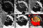
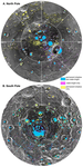
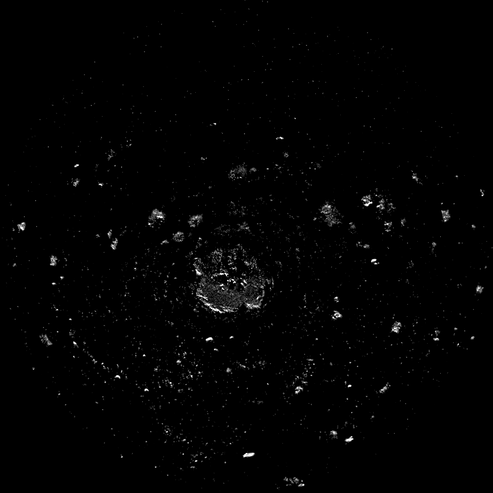
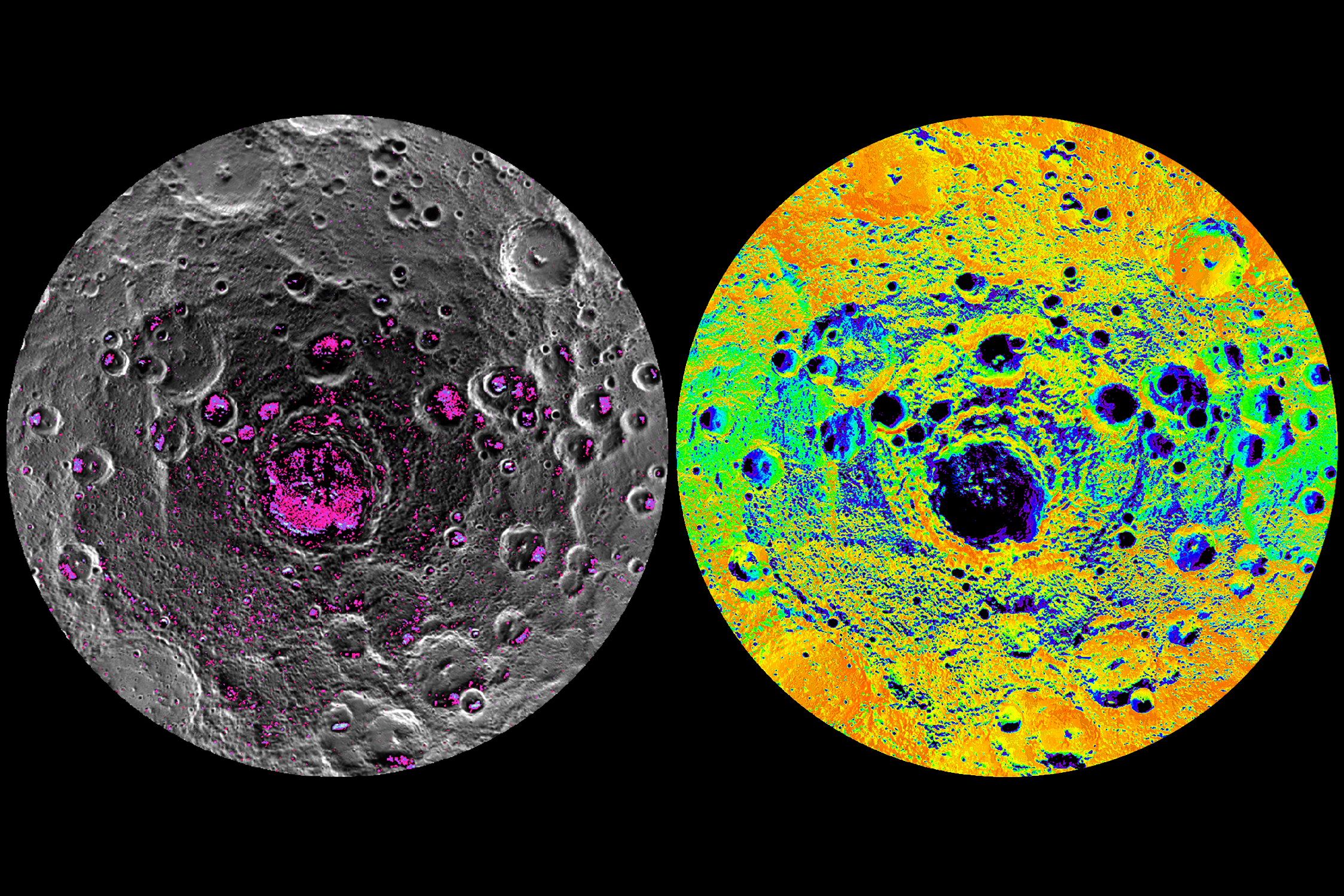
* New Arecibo radar observations of Mercury’s south pole reveal numerous radar-bright deposits and substantially increase coverage
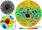
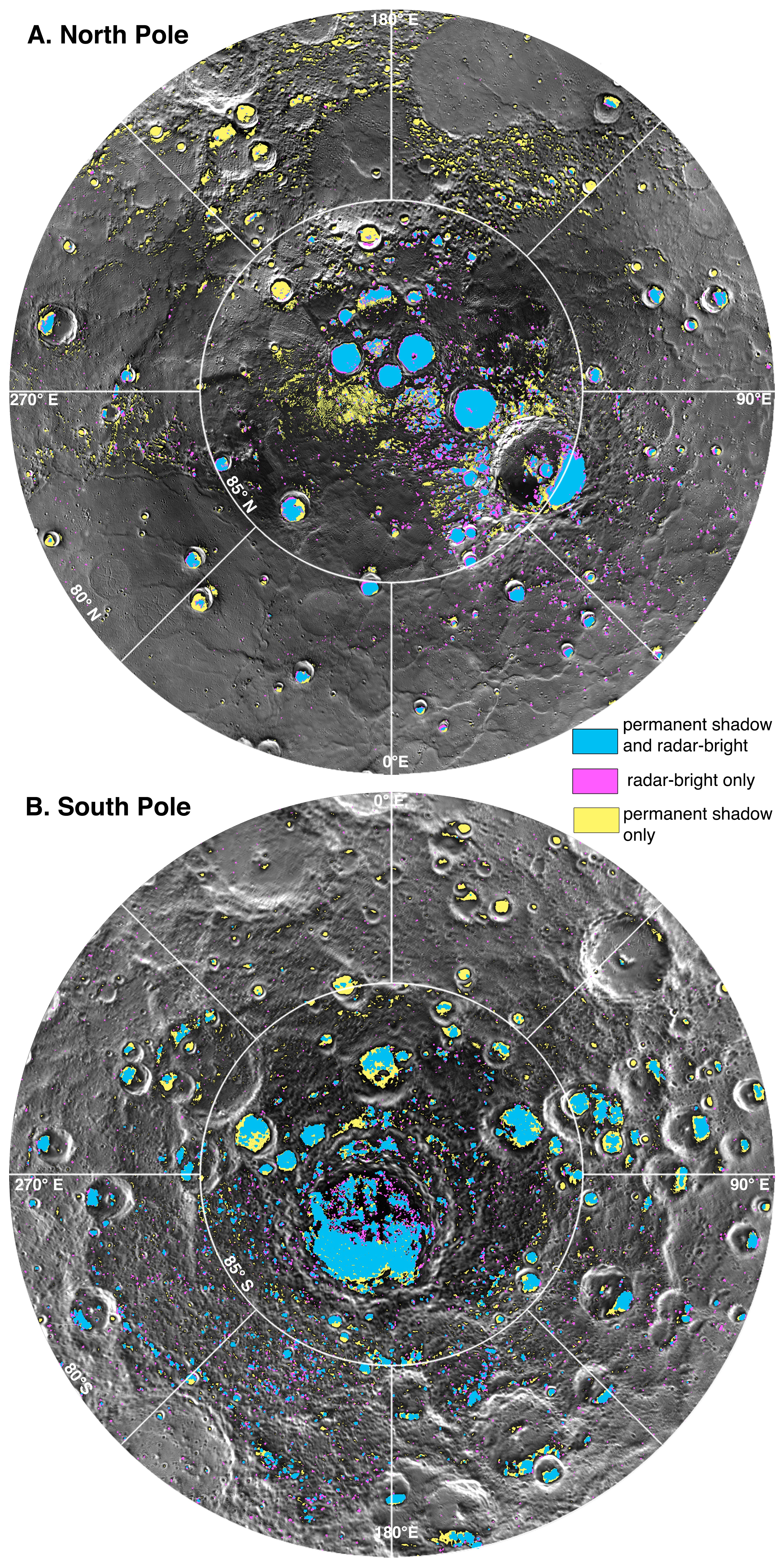
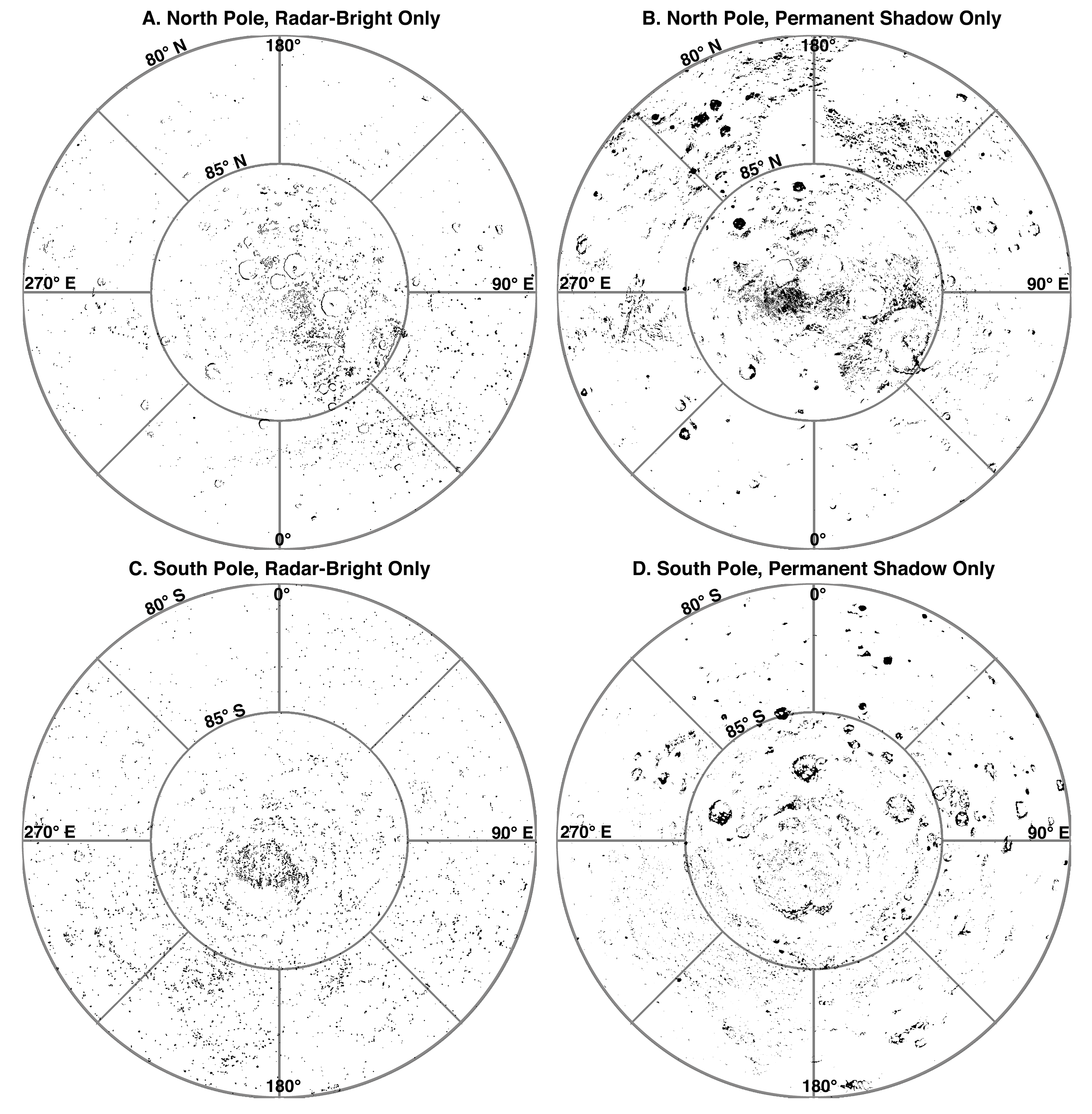
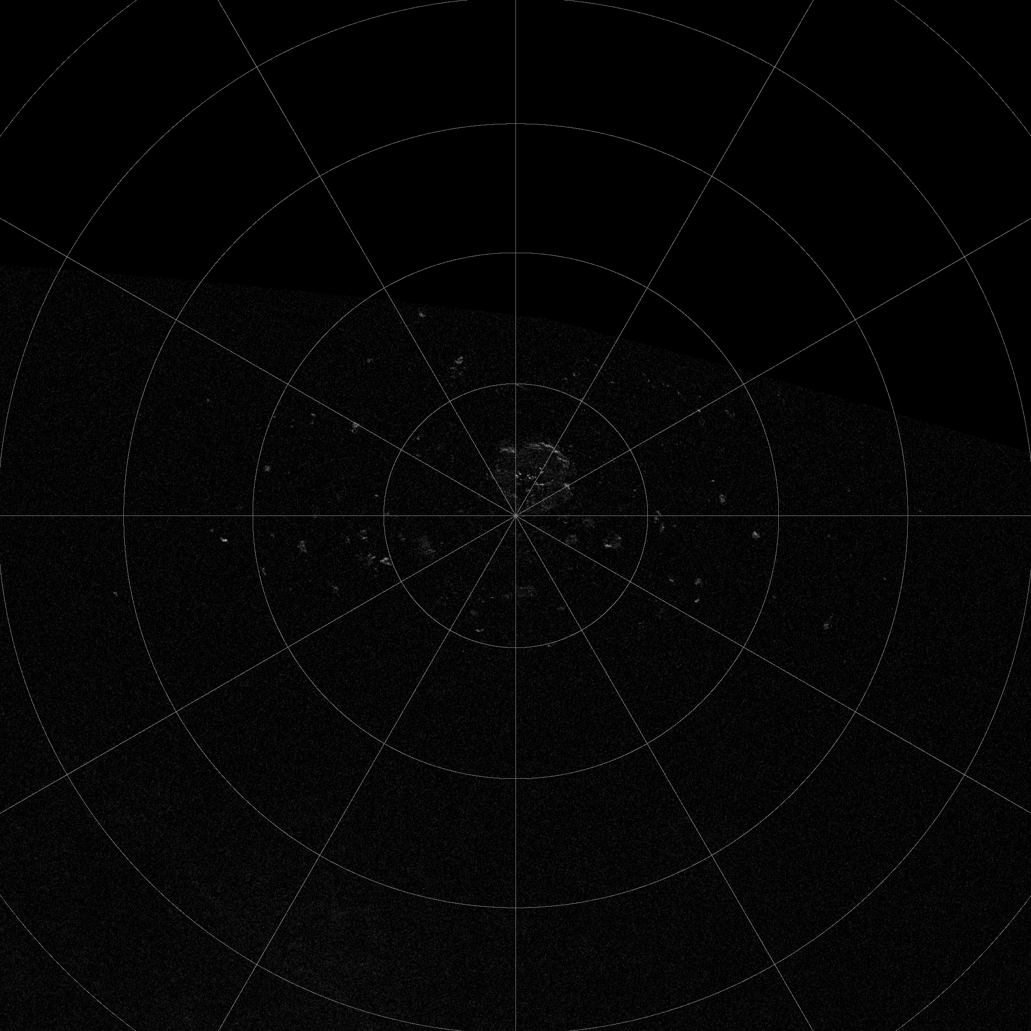
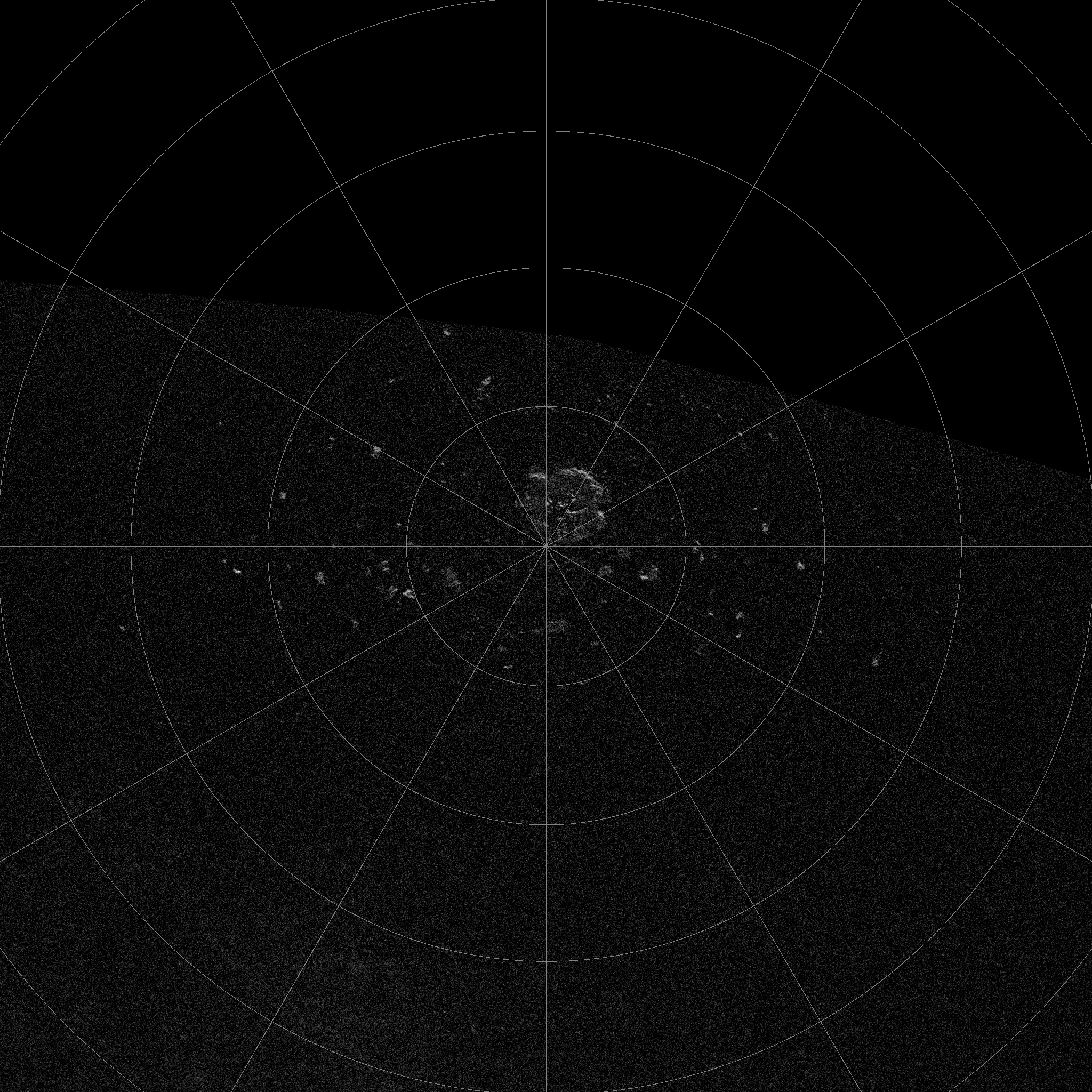
* Mercury’s south polar deposits are shown to be located in regions of permanent shadow, consistent with being water ice
* The observed uneven distribution of water ice at both of Mercury’s poles may suggest a large impact event as the source of the water
Abstract:
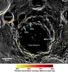
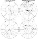
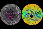
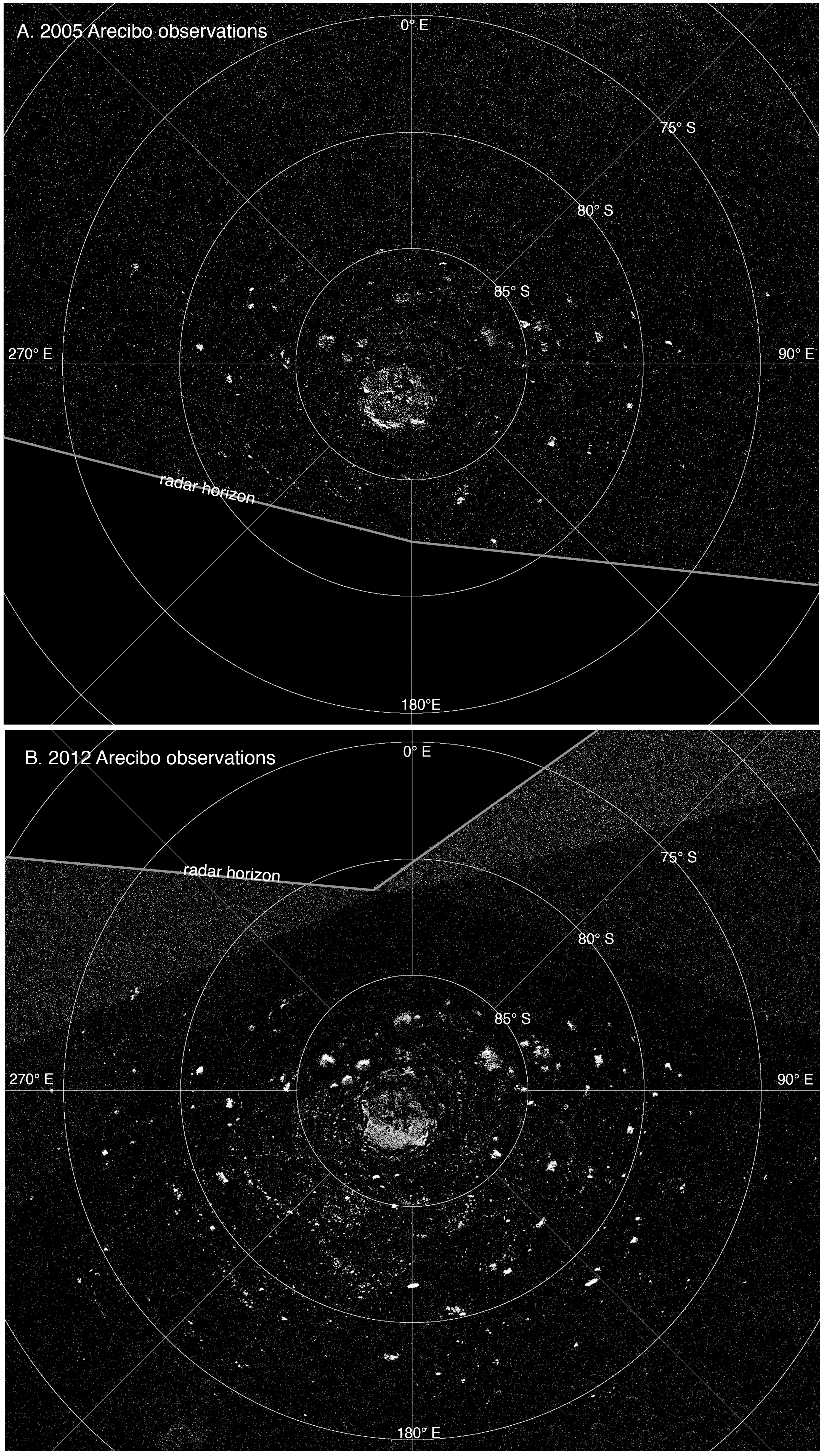
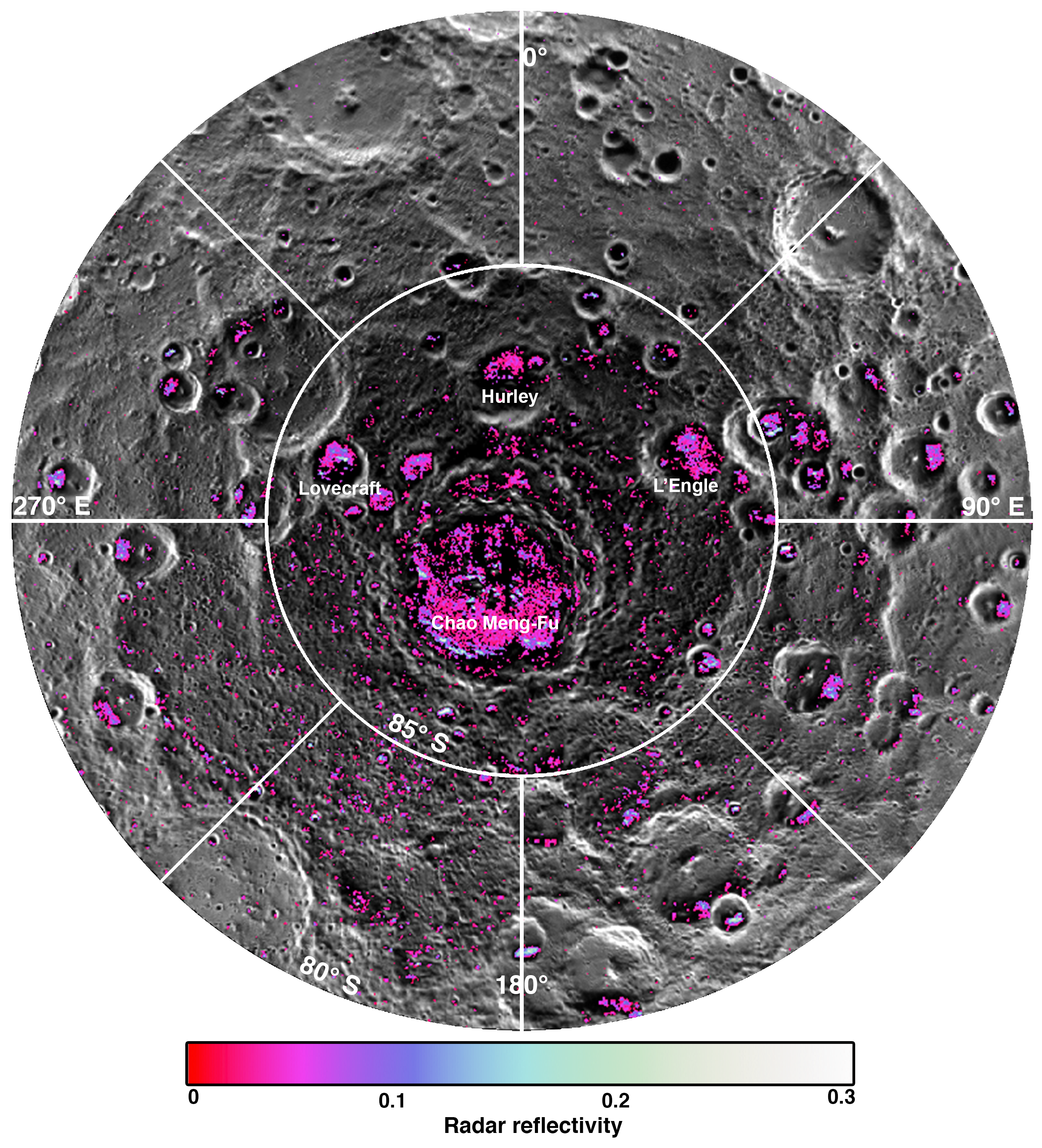
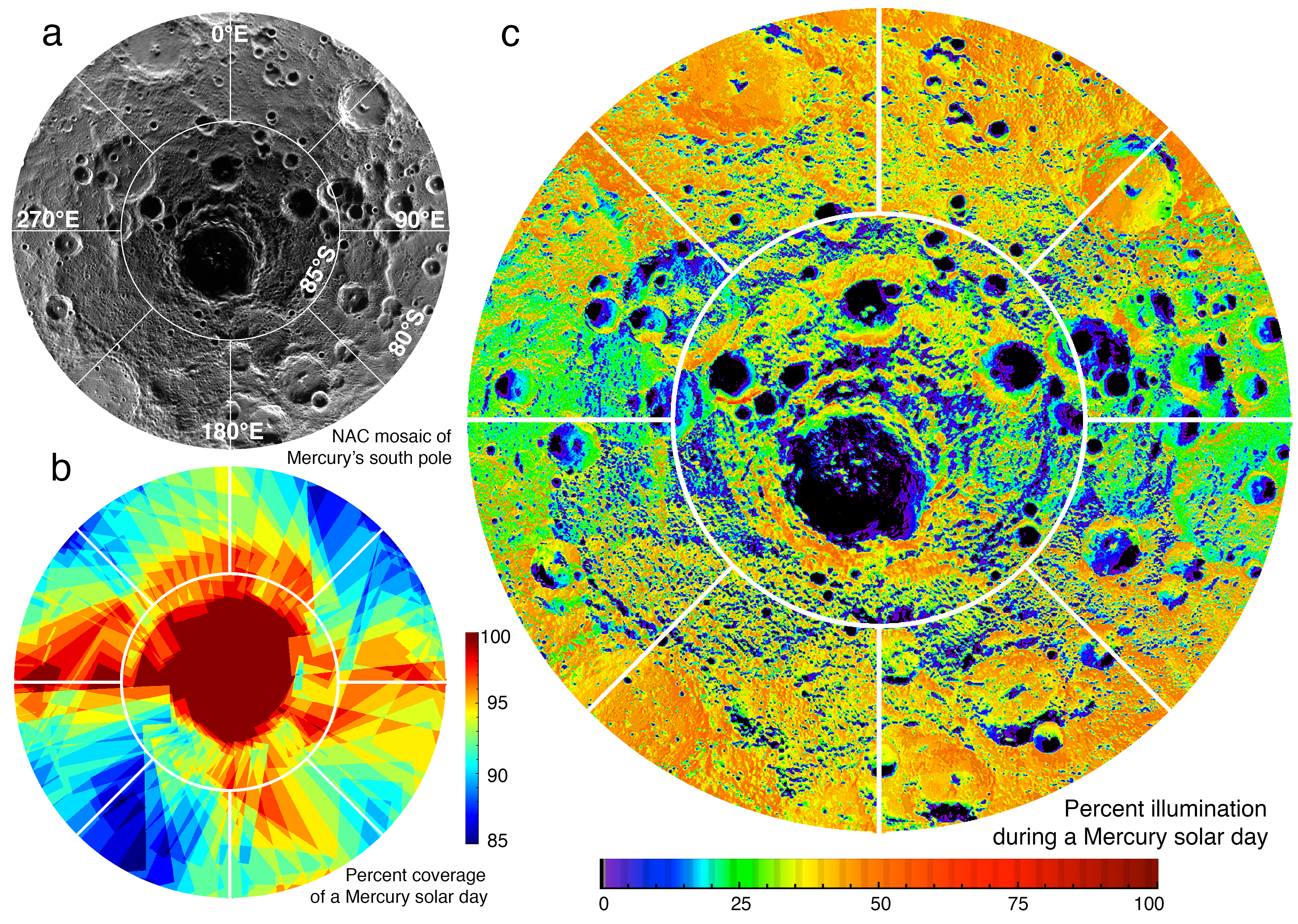
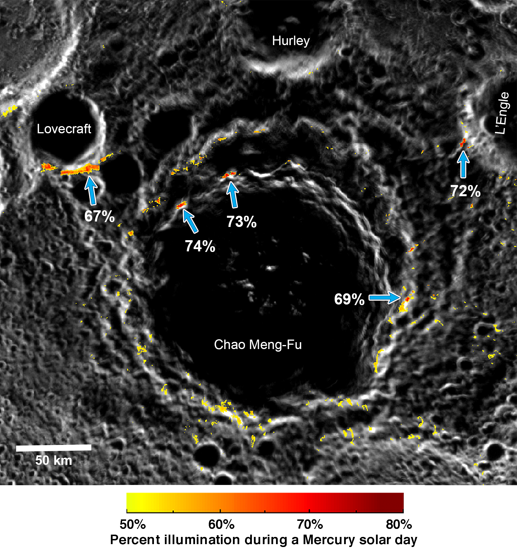
There is strong evidence that Mercury's polar deposits are water ice hosted in permanently shadowed regions. In this study, we present new Arecibo radar observations of Mercury's south pole, which reveal numerous radar-bright deposits and substantially increase the radar imaging coverage. We also use images from MESSENGER's full mission to determine the illumination conditions of Mercury's south polar region at the same spatial resolution as the north polar region, enabling comparisons between the two poles. The area of radar-bright deposits in Mercury's south is roughly double that found in the north, consistent with the larger permanently shadowed area in the older, cratered terrain at the south relative to the younger smooth plains at the north. Radar-bright features are strongly associated with regions of permanent shadow at both poles, consistent with water ice being the dominant component of the deposits. However, both of Mercury's polar regions show that roughly 50% of permanently shadowed regions lack radar-bright deposits, despite some of these locations having thermal environments that are conducive to the presence of water ice. The observed uneven distribution of water ice among Mercury's polar cold traps may suggest that the source of Mercury's water ice was not a steady, regular process but rather that the source was an episodic event, such as a recent, large impact on the innermost planet.
Plain Language Summary:
Even though Mercury is the planet closest to the Sun, there are places at its poles that never receive sunlight and are very cold - cold enough to hold water. Our new results from the Arecibo radar observatory reveal numerous locations of water ice near Mercury's south pole. Using images from NASA's MESSENGER mission, we mapped how much sunlight Mercury's south pole receives over one complete day and identified locations that are always in shadow. The permanently shadowed locations match the features seen in the Arecibo images, as expected for water ice. However, about 50% of the permanently shadowed locations lack water ice, and we find that this is similar for both Mercury's north and south poles. What would cause this uneven distribution of water on Mercury? We conclude that this result is most consistent with Mercury's water coming from a large, recent impact of a comet on the planet.
PMCID 5853133
https://www.ncbi.nlm.nih.gov/pmc/articles/PMC5853133/
| Preview | Filename | Description |
|---|---|---|
|
|
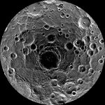
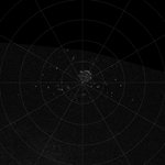
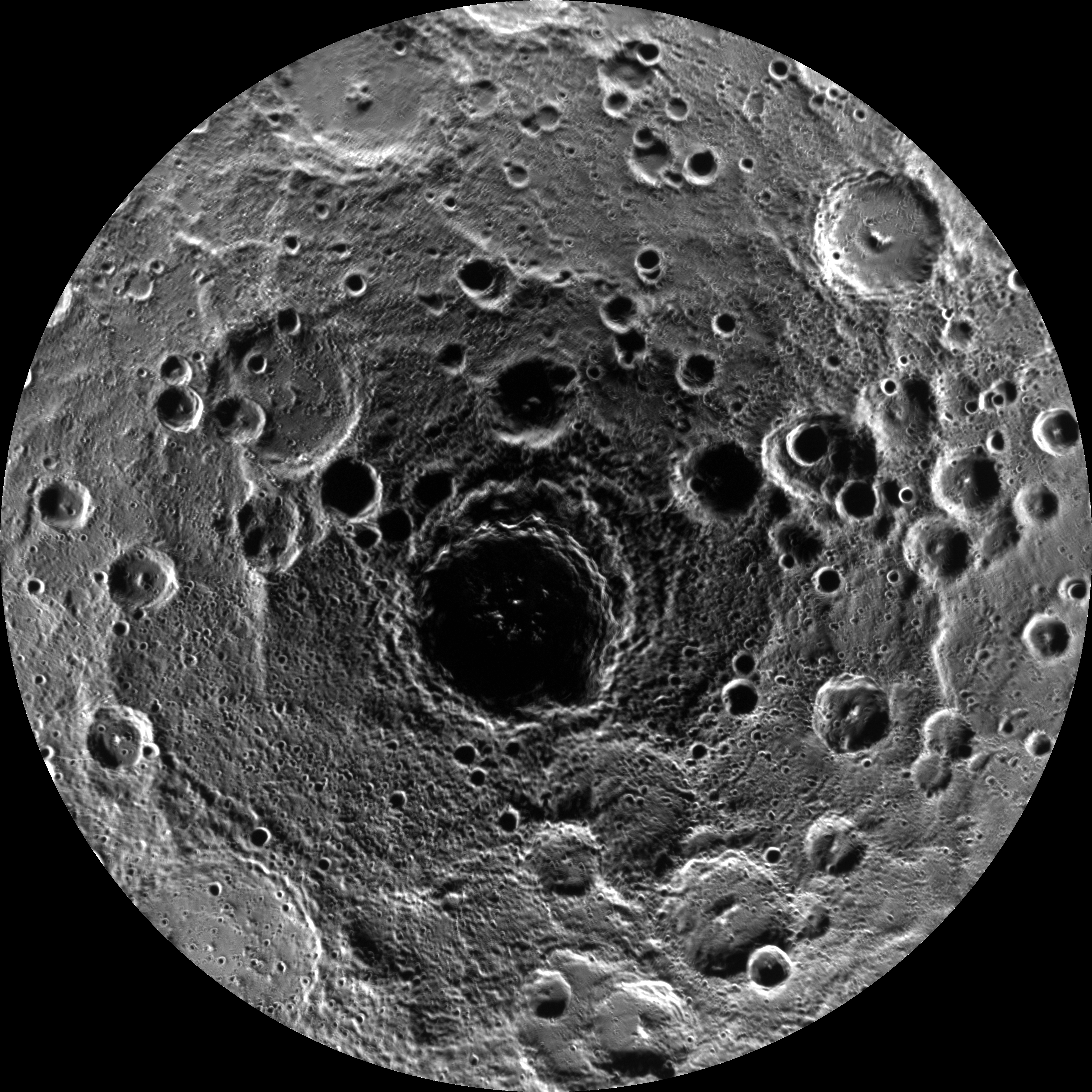
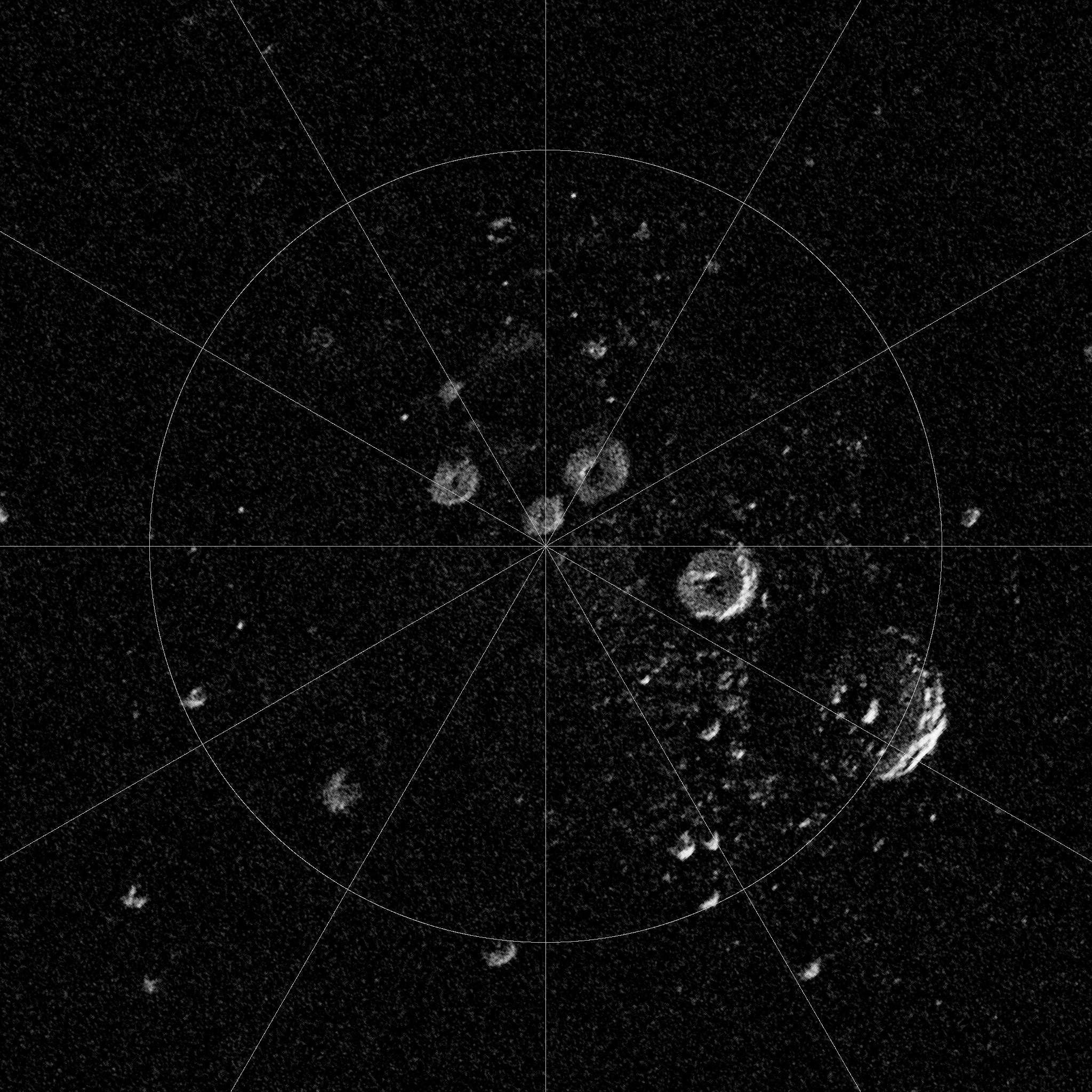
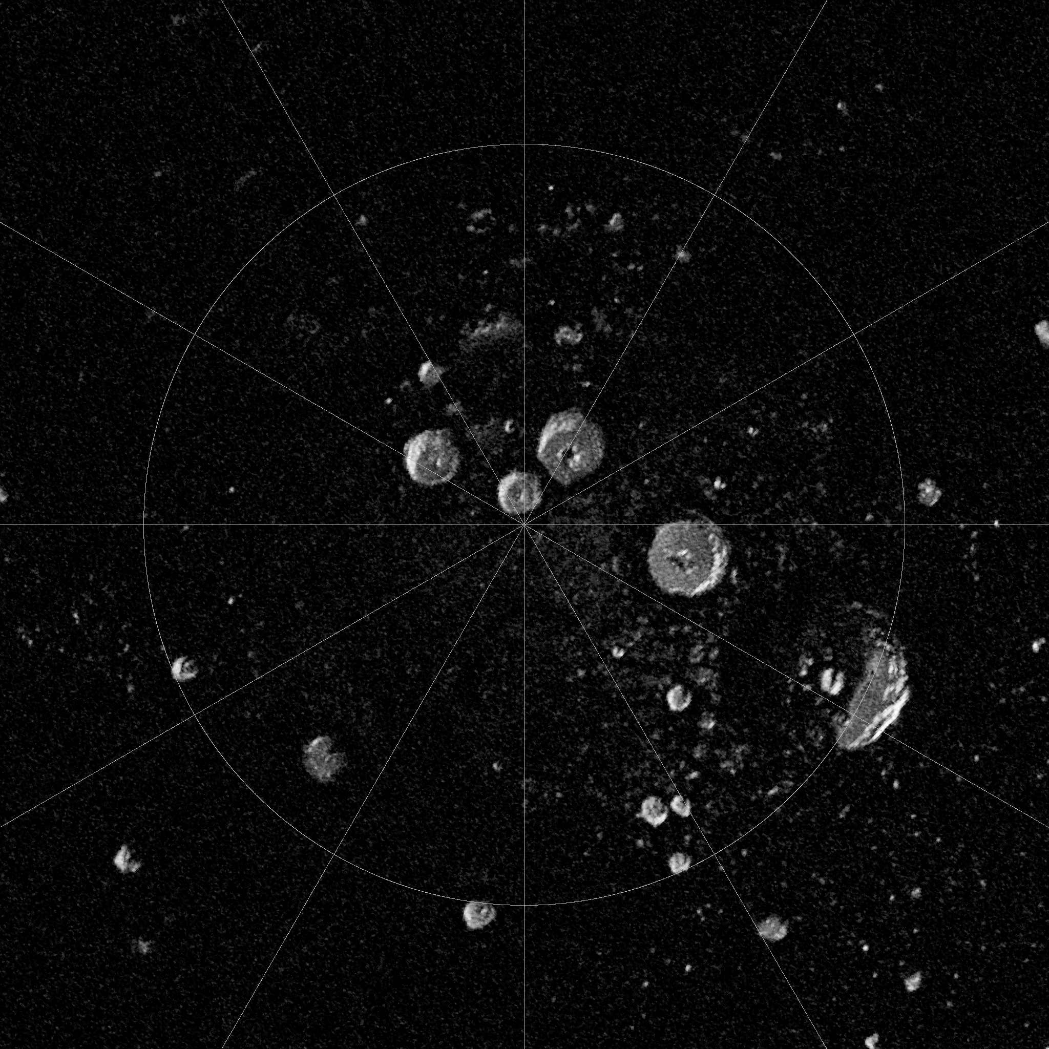
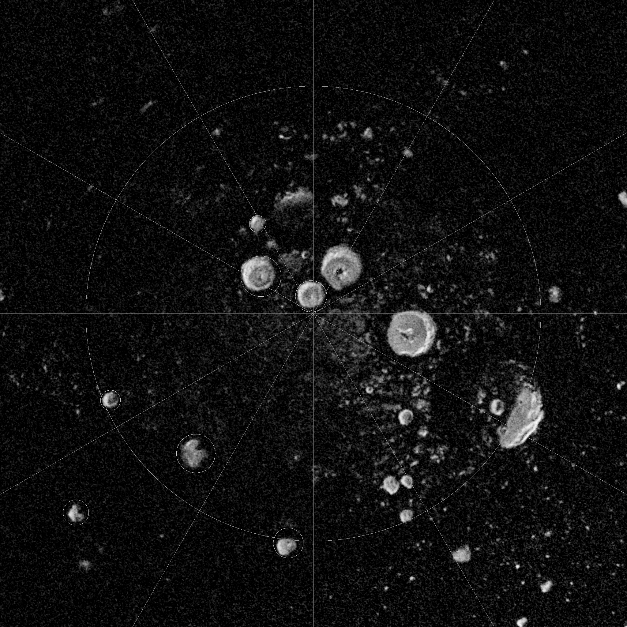
fig2_nacmosaic.cub |
Fig.2 NAC south pole average image mosaic, ISIS cub format |
|
fig2_nacmosaic.png |
Fig. 2 NAC south pole average mosaic mosaic, PNG image format |
|
|
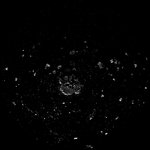
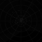
fig2_radar.cub |
Fig. 2 Combined 2005 and 2012 Arecibo radar image, ISIS cub format |
|
fig2_radar.png |
Fig. 2 Combined 2005 and 2012 Arecibo radar image, PNG image format |
|
|
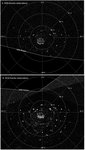
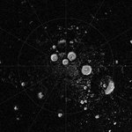
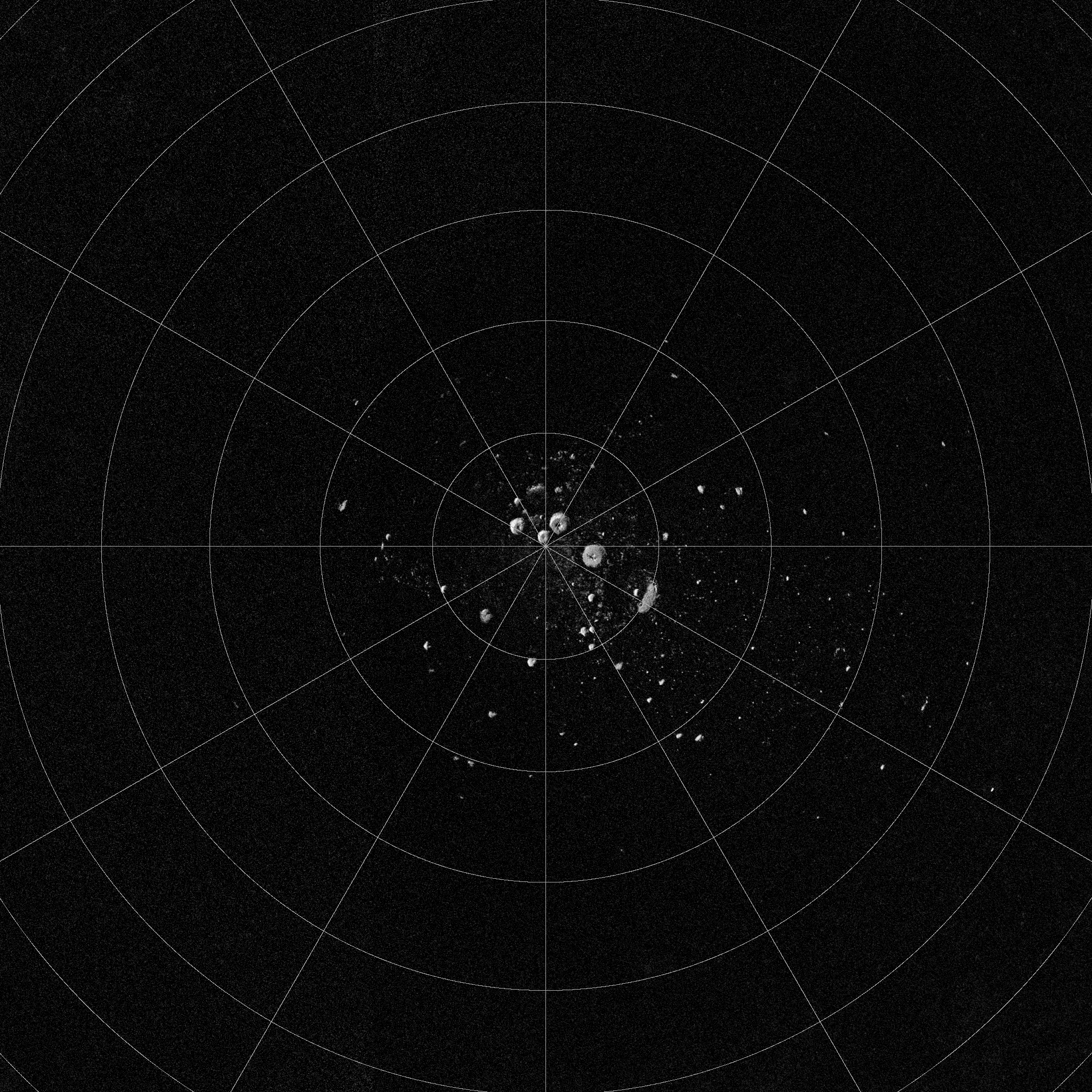
fig3b_weighted_coverage.cub |
Fig. 3b Weighted coverage map, ISIS cub format |
|
|
fig3c_percent_illumination.cub |
Fig. 3c Illumination map, ISIS cub format |
|
|
fig6b_sp_permanent_shadow.cub |
Fig. 6b Permanent shadow map, ISIS cub format |

|
fig6b_sp_permanent_shadow.png |
Fig. 6b Permanent shadow map, PNG image format |
|
|
nac_southpole_movie.mp4 |
Movie of NAC mosaics used to determine the illumination conditions over one Mercury solar day for Mercury's south polar region, MP4 format |
|
|
nac_southpole_movie.mov |
Movie of NAC mosaics used to determine the illumination conditions over one Mercury solar day for Mercury's south polar region, MOV format |
|
|
southpole_shadowedcraters.xlsx |
List of locations and diameters of Mercury's south polar shadowed craters |
|
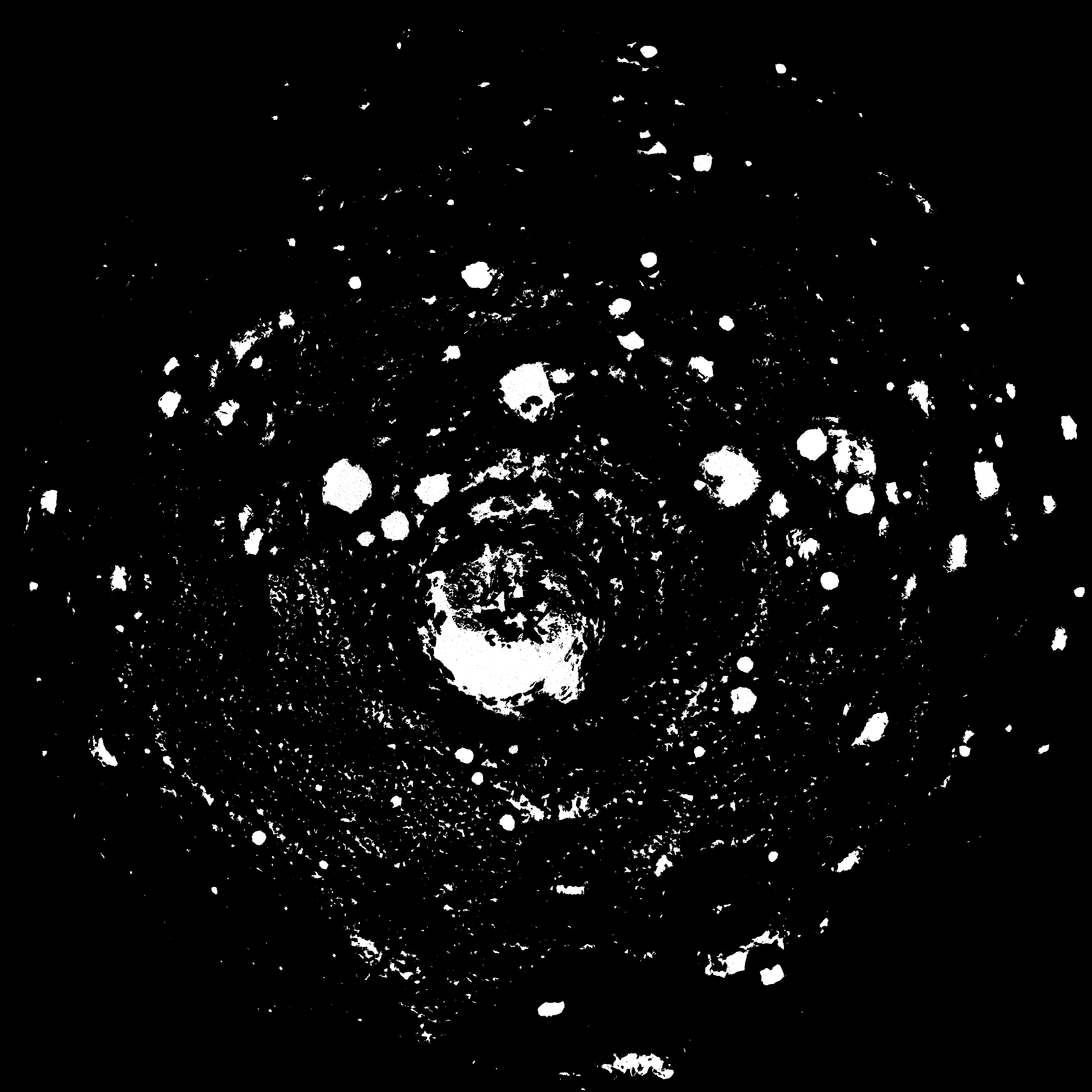
fig1_radar.png |
High-resolution Fig. 1 |

|
fig2_radar_combined.png |
High-resolution Fig. 2 |
|
fig3_illumination.png |
High-resolution Fig. 3 |
|
fig4_max_illumination.png |
High-resolution Fig. 4 |
|
fig5_chaomengfu.png |
High-resolution Fig. 5 |
|
fig6_north_south.png |
High-resolution Fig. 6 |
|
fig7_only_regions.png |
High-resolution Fig. 7 |
|
chabotetal_fig2_fig3.png |
Article highlight image |
|
|
document_2015.pdf |
Harmon document for Arecibo radar data files |

|
image2a.gif |
Harmon et al (2011) - Radar 2a |
|
|
image2a.dat |
Harmon et al (2011) - Radar 2a |
|
|
image2b.dat |
Harmon et al (2011) - Radar 2b |
|
|
image3a.dat |
Harmon et al (2011) - Radar 3a |

|
image3a.gif |
Harmon et al (2011) - Radar 3a |
|
|
image3b.dat |
Harmon et al (2011) - Radar 3b |
|
image3b.gif |
Harmon et al (2011) - Radar 3b |
|
|
image4.dat |
Harmon et al (2011) - Radar 4 |

|
image4.gif |
Harmon et al (2011) - Radar 4 |
|
|
image4h.dat |
Harmon et al (2011) - Radar 4h |
|
|
image5.dat |
Harmon et al (2011) - Radar 5 |
|
|
image7a2015.dat |
Harmon et al (2011) - Radar 7a 2015 |
|
image5.gif |
Harmon et al (2011) - Radar 5 |
|
image7a2015.gif |
Harmon et al (2011) - Radar 7a 2015 |
|
image7a.gif |
Harmon et al (2011) - Radar 7a |
|
|
image7a.dat |
Harmon et al (2011) - Radar 7a |
|
image8.gif |
Harmon et al (2011) - Radar 8 |
|
|
image8.dat |
Harmon et al (2011) - Radar 8 |
|
|
locatef.pdf |
Harmon locate file - loaded as PDF to allow posting to this site |
